25/10/2019 | Many tropical coasts are still difficult to access and therefore natural resource monitoring remains challenging and expensive. New technologies now accessible to the public are revolutionizing the way how we can address conservation problems. This is the case for consumer-grade drones that are increasingly being used to monitor and track changes in ecosystems at a very high temporal and spatial resolution overcoming the limitations of many standard methods.
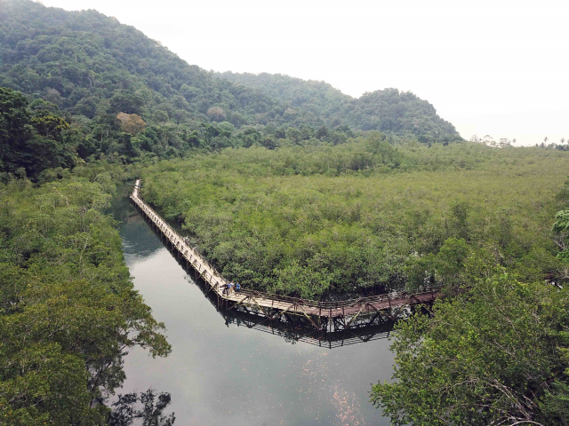
A group of scientists at ZMT in cooperation with the University of Bremen and Colombian partners (Universidad del Valle and Universidad Nacional) has been using drones in the last three years to monitor mangroves, coral reefs and rocky shores in a remote MPA of the Colombian Pacific coast (Utría National Park). The scientists are proving that drones can be an extremely useful tool for monitoring these critical ecosystems that are known to be nursery areas for many commercially important species in this region.
The last mangrove monitoring in this region was done 10 years ago. Due to the often reduced budgets that MPA have in tropical countries, habitat monitoring is done very sporadically. This difficulty directly influences how MPA perform and deliver their benefits to the society. With the use of drones, the scientists at ZMT are proving that monitoring the complete 100 mangrove hectares of this MPA can be done in less than 4 days with the aid of drones. The product that is obtained has a resolution of less than 5 cm and provides the opportunity to derive characteristics of the mangrove forest that are useful for management.
A recent visit to this MPA by the scientists also brought the opportunity to document the aerial exposure of the largest coral reef in the region. Using drones during four consecutive days the group of researchers was able to document and quantify the consequences that the phenomenon has for the vulnerable organisms. In the coming months, the researchers will be busy analyzing the thousands of drone imagery captured in the last years in this MPA.
Publications
Castellanos-Galindo GA, Casella E, Mejia-Renteria JC, Rovere A (2019) Habitat mapping in remote coasts: evaluating the usefulness of lightweight unmanned aerial vehicles for conservation and monitoring. Biological Conservation https://doi.org/10.1016/j.biocon.2019.108282
Mejia-Renteria JC, Castellanos-Galindo GA, Osorio-Cano JD, Casella E (2019) Subaerial exposure of coral reefs during spring low tides in the Eastern Pacific Bulletin of Marine Science https://doi.org/10.5343/bms.2019.0085


