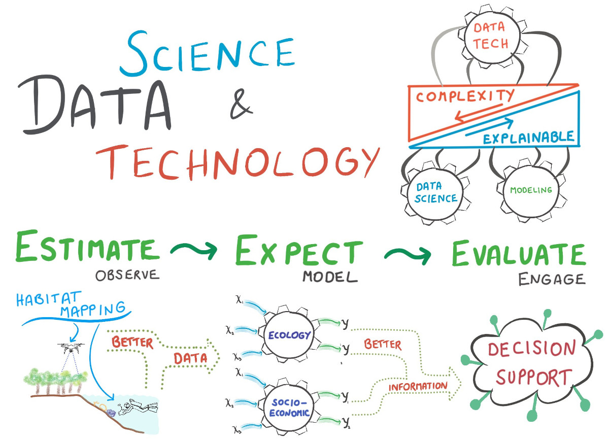
In the Data Science and Technology (or datech) group, we explore ways to leverage the latest techniques in data science and machine learning towards the benefit of tropical marine science. We are engaged in habitat mapping, image analysis, deep learning, proximal & remote sensing and environmental decision science.
As an interdisciplinary group by definition, we are active in rather diverse topics from spectral physics to scientific diving to bayesian statistics and more. As we are curiousity-driven with a focus on method development, we build tools – both hardware and software – to improve the scalability of our environmental observations and the objectivity of derived insights.
We embrace diversity in cultures, topics and methods to pull together a rich portfolio of projects. We also champion the open science movement, and co-manage the ZMT datalab for collaborative data science. The research group is led by Dr. Arjun Chennu.
Research Highlights
Here are a few highlights from the research projects of our group. If you’re interested in pursuing a project with us, then write us an e-mail with a description of your project idea, intended timeline and your CV.
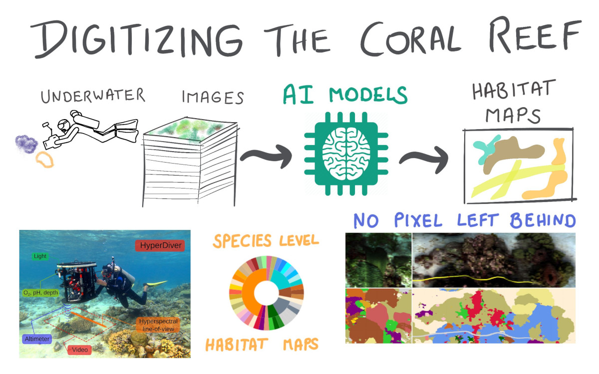
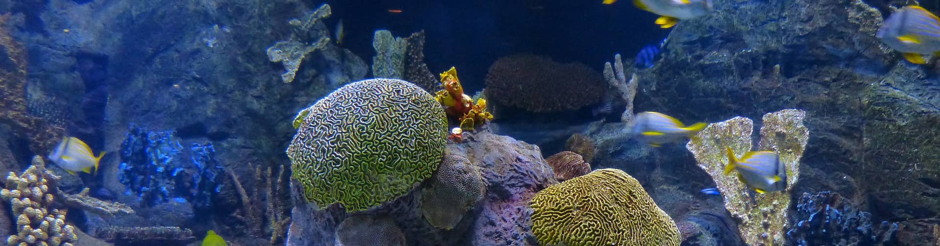
Coral reefs are challenging to measure because they are not only very biodiverse habitats, but are also structurally complex. The profuse biodiversity in a reef is hiding in plain sight, and traditional methods fail to capture the reef community structure. Using the HyperDiver, the world’s first diver-operated hyperspectral surveying system, we captured transect images with rich spectral detail in several coral reefs. We developed an AI-based workflow that can classify each pixel into one of 45+ classes (several down to species level) with high accuracy. The scalable workflow was used to process more than 1 billion samples to produce the most dense and detailed maps of reef habitats to date.
For more details refer to the HyperDiver paper, workflow paper and the data paper.
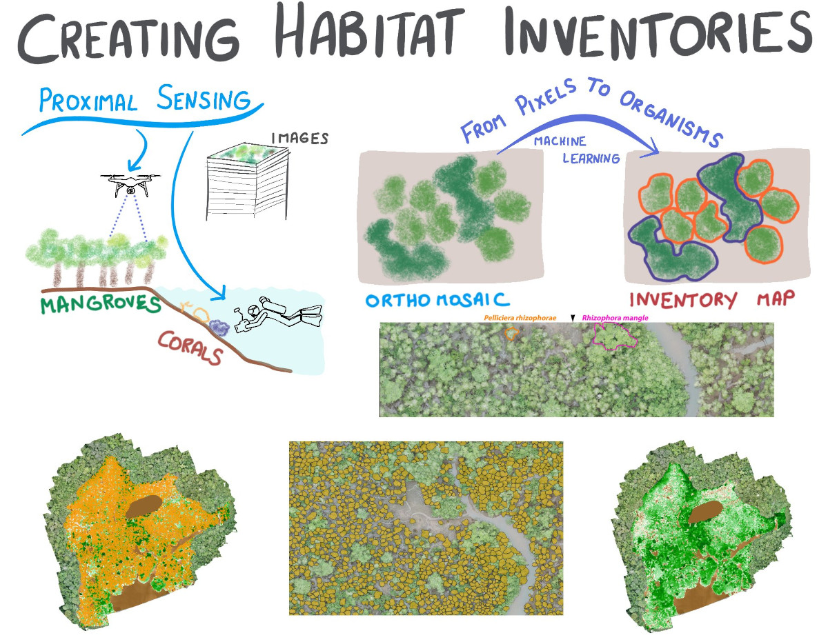
Although an ecosystem or population consists of organisms, it is common practice to describe a habitat community as area cover a semantic map. We leverage the latest AI tools and GIS techniques to extract organism-level information automatically. We seek to create inventories of habitats to improve our accounting of precious coastal ecosystems, such as coral reef and mangrove forests.
We demonstrate this with an AI workflow to automate and scale up the creation of inventories of mangrove forests from aerial images. The images were captured with an inexpensive UAV above mangrove forests in a national park in the Colombian Pacific coast, with a community that forms very dense canopies with nearly no gaps between the tree crowns. Our proposed workflow uses two deep learning networks in parallel: the first network detects and segments the crowns of individual trees of an endemic mangrove species, while the second network detects the area cover of surrounding land-cover classes, including a second mangrove species, juvenile mangrove trees, as well as mud and water areas. We developed a new heuristic algorithm that intelligently merges image tiles while preserving delineated tree crowns at the edges. With this information we produce a comprehensive inventory of a mangrove forest with unprecedented detail.
For more details refer to the featured paper in Remote Sensing.
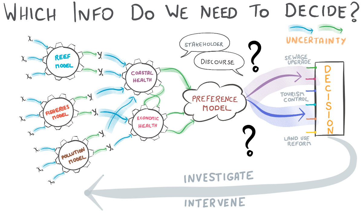
Environmental management decisions need to be made in the face of large uncertainties. Confronted with these uncertainties, an intuitive response is to collect additional information assuming that more info will reduce uncertainty. However, this costs time and effort which could be better allocated to management actions. When we know enough about a system to make a sensible decision, requesting “more science” becomes rather a technique to delay action. We seek to develop a decision support framework that supports iterative application by providing a ranked listing of the system attributes that most contribute to decision uncertainty. This can allow managers and decision makers to estimate the value of information/data before it has been collected. Using a detailed coral reef and fisheries simulation model, we developed novel optimizations and analyses to develop the value of information concept further for environmental decisions. We extend the analysis to also consider if the largest decision uncertainties come from our predictions or from the stakeholder preferences about an ecosystem state.
Read further details in this paper and this paper.
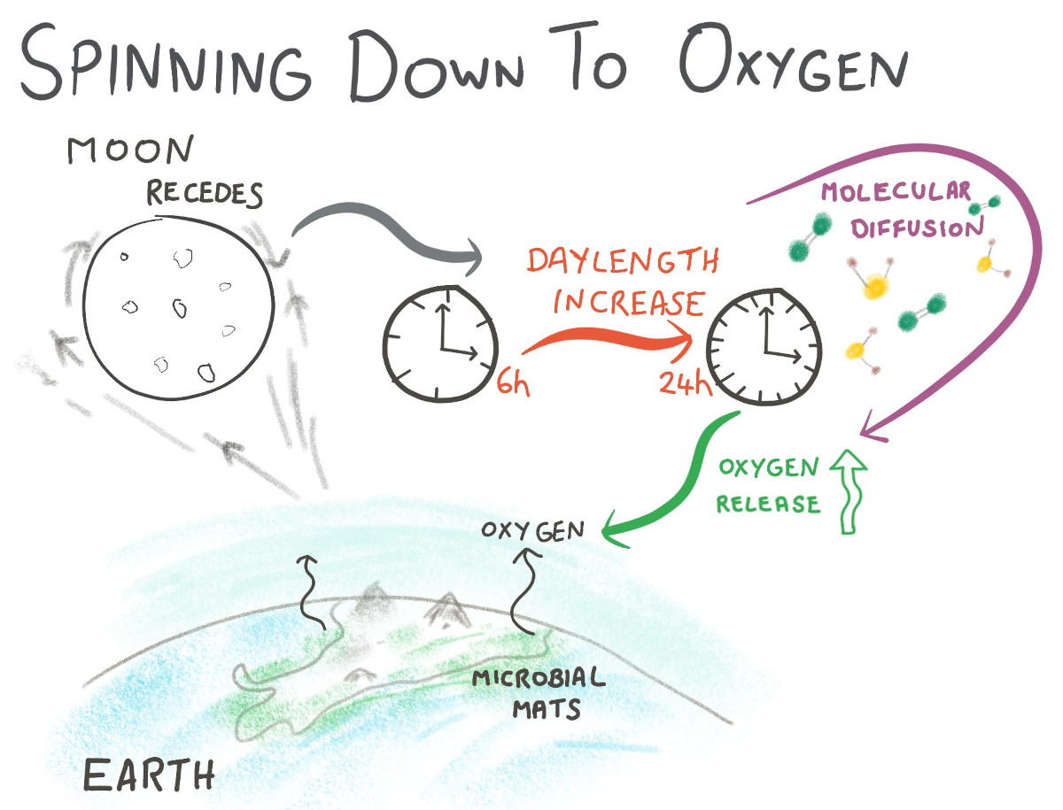
Life on Earth today relies on the presence of oxygen, however oxygen was not always available in the atmosphere. A long-standing mystery in Earth sciences is why the oxygen levels appears to have risen haltingly over time in a step-wise manner. Virtually all oxygen on Earth was and is produced by photosynthesis, which was invented by cyanobacteria when our planet was still rather young. If oxygenic photosynthesis is driving the increase in oxygen, then why did it stop increasing for such a long time and restart again?
In a recent study, we posit a novel mechanism how the Moon has influenced atmospheric oxygen over geologic time scales by changing the length of the day. The daylength has changed considerably over Earth’s history, perhaps from 6h to today’s 24h, owing to tidal friction by the Moon. Using measured and modeled simulations of microbial photosynthesis over various day lengths, we show that there is a fundamental link between daylength and how much oxygen can be released by ground-dwelling microbes. The release of oxygen from bacterial mats, because it is limited by the speed of molecular diffusion, is subtly uncoupled from the sunlight dynamics and creates this daylength effect that longer days release more oxygen. It’s a very small effect, but working on every sunlit day for millions of years, it can produce changes that we think are global in significance.Thus, the dynamics of the Earth-Moon system possibly had major impacts on global oxygen levels during critical turning points of Earth’s biogeochemical evolution towards a profusely oxic world.
Read further details in the paper, the press release or in the media articles by Popular Science. Additional sources are available in the altmetric page.
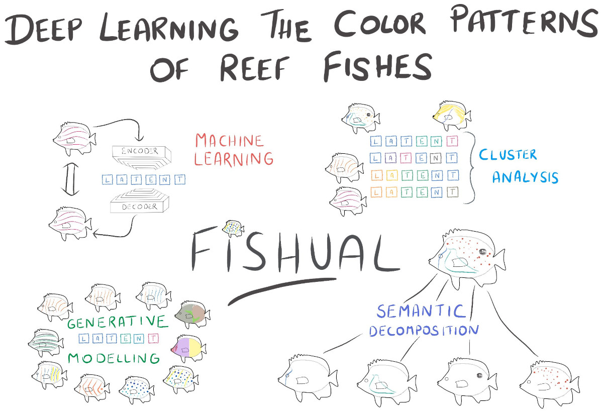
Reef fishes display a stunning variety of body shapes and color patterns that compose arguably the most spectacular scenes in the natural world. Coral reefs are highly visual environments and color pattern plays an important ecological and evolutionary role in reef fishes. From an evolutionary perspective, most reef fish species arose within the last five million years and even closely related species differ greatly in terms of color pattern. Although the color patterns of reef fishes is probably the most important part of their phenotypic description, our ability to decompose and describe the patterns remains limited. Color pattern is actually not a single trait in reef fishes but a collection of traits.
In this ongoing Fishual project, we seek to deconstruct the visual appearance of reef fishes using advanced image analytics. We leverage neural networks to enable a quantitative description of the geometry and color patterns of reef fishes. The design of the project will target a semantic decomposition of the visual attributes of reef fishes.